Greetings from Williamsburg, Virginia!
Well, we headed up Highway 4 to Angels Camp and Murphys but just kept on going! We landed in the Colonial Capital of America, Williamsburg, Virginia. Check back for upcoming stories about our journey here and life in The Burg.

The Capitol building at the end of Duke of Gloucester St., locally known as DOG St.
California Gold Country
Copperopolis – first stop on our tour through the California Gold Country.

Unlike most of the mining towns in the Calaveras County, Copperopolis’ claim to fame is not gold, but copper. It was founded in 1860 by William K. Reed, Dr. Allen Blatchly and Thomas McCarty, at the site of the second major discovery of copper ore in the region (the first was nearby Telegraph City). Main Street, pictured above, before the 1867 fire. In 1863, William Reed built a toll road where teams of oxen hauled copper ore to Stockton, then shipped downriver to San Francisco. From there, loaded the ore on to ships and sailed around Cape Horn to smelters in Boston. The turnoff to Reed’s Turnpike from Main Street still exists today.

Main Street today. In the lower right hand corner of the picture is the Copperopolis Congregational Church. It was built in 1866 in the Gothic Revival style. The bricks used for its construction were removed from buildings being torn down in nearby Columbia so miners could mine the ground underneath. The rich copper vein ran parallel to Main Street where the population boomed to 10,000+ individuals between 1860 – 1867. During the boom, buildings of all descriptions offering every service imaginable, lined Main Street. The town became the second largest supplier of copper to the Union Army during the Civil War. After the Civil War, demand dropped but the mines continued to operate and experienced periodic booms during the two World Wars. From 1861 to 1946, the mines produced over 72 million pounds of copper. The mines have been closed since 1946, but there are remnants of mine structures and equipment all over town.

Copperopolis Town Square – “It’s a whole new town with a historic past.”
If you take the turn on to Reed’s Turnpike from Main Street, you will wind your way through the countryside for a couple of miles until you come to “New Copper”, also know as Copperopolis Town Square. Developers had barely finished construction of part of this new section of town next to Hwy 4, when the 2007 recession hit. It hung on during the downturn and has been making its way ever since. There are some good restaurants – Griffs BBQ and Gold Dust Pizza, along with Roaster’s Coffee Shop. There are also a couple of wine bars, ice cream shop, Copperopolis Olive Oil Company, assorted gift and antique shops, and a unique game store. Music concerts and weekly Farmers Market are held during the summer in the main square.

Lake Tulloch
Part of the Stanislaus River, Lake Tulloch is our closest lake. It was formed when the Lake Tulloch dam was completed in 1958. It covers 1,260 surface acres and provides access to boating, fishing, swimming, kayaking, water skiing and camping.
Next stops on the California Gold Country tour:
Heading up Hwy 4 to Angels Camp and Murphys.
Happy Labor Day, 2016
For the one or two of you that might still be receiving notifications about my blog, at long last here’s an update! After I left you hanging last year in Portugal, Nancy and I headed to Merida, Spain. Merida is in western, central Spain on Autovia A-66. Also known as Ruta de la Plata, it runs north / south, close to Portugal, from Gijon on the northern coast to Sevilla in the south. Total length is 809 km or 503 miles. We drove north from Sevilla to Merida, stopping on the way in Zafra. The towns along A-66 are relatively small and do not get the crowds of tourists of the larger cities.
Zafra


The Alcazar or fortress in Zafra was built between the years of 1437 and 1443. It is now a Parador, part of a chain of very nice hotels owned by the Spanish govenment.
Merida
For Roman history and archaeology buffs, check Lonely Planet’s Merida webpages:
https://www.lonelyplanet.com/spain/extremadura/merida


Moyglass, Enniskillen, Ireland
From Merida, we drove back to Sevilla and flew to Dublin, Ireland. We stayed there a few days and then took a bus to Enniskillen. There we stayed with John Spence and his family at the Spence ancestral home. Edward Spence was Nancy’s great-grandfather. Around 1870, he emigrated to America and traveled to the West. He became a mining engineer and lived in numerous mining towns. Golden City, CA, (about 20 miles from our current home in Copperopolis), Virginia City, Nevada, Contention, Arizona (near Tombstone) and eventually moving to Los Angeles, CA. The Spence ancestral home, Moyglass, has been in the Spence family for over four hundred years. We then flew from Dublin to San Francisco on Aer Lingus, Ireland’s airline.


Monkey Puzzle tree. Native to Chile, planted on Moyglass grounds. So named because an English observer said that it would “puzzle a monkey on how to climb it.”
Mountain Ranch, California
Last September 2015, the Butte wildfire burned over 75,000 acres in the Sierra foothills about 100 miles east of the San Francisco bay area. We owned a 41 acre parcel that was completely within the burn zone perimeter and entirely burned.
Before:


After:


Calaveras County had a fire clean-up program where they sent clean-up crews to burned properties. The crews cleaned-up all of the burn debris and any toxics left in the soil. Fortunately for us, our Mountain Ranch neighbors, whose parcel only partially burned, were interested in buying our parcel. The easement to our property cut through their two properties. Buying our property allowed them to complete an 100+ acre parcel.
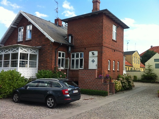
After the fire, Nancy and I started looking around other parts of Calaveras County. In February, 2016, we purchased a house on 1.3 acres in Copperopolis, about 1 hour from Mountain Ranch. Copperopolis is 12 miles west of Hwy 49, just off Hwy 4. Copper was discovered here in 1860. The mine is gone but the old town and a “new” town are here now. Lake Tulloch, Pinecrest, Lake Alpine and many other lakes are nearby. We sold our house in Albany and moved to Copperopolis in May, 2016.
Copperopolis, California


1 – Copper house 2 – View from back deck


Lots of spring grass here, so we needed a bigger tractor mower!


Yosemite Valley


1 – Lake Alpine, up Hwy 4 2 – Sunset from our porch
So that’s a quick summary of the past 16 months. Next post will have local towns and sights.
Thanks for reading!
Bom dia!

Sunrise in Monte Gordo , Portugal. It’s the first town on the Portuguese side of the Rio Guadiana along the Algarve. We’re staying in an apartment on the beach through the weekend. Great for beach walks and swimming in the Atlantic!

After Tarragona, we took the train south along the coast about 160 miles to Valencia. Valencia is Spain’s third largest city with a population around 3/4 million. Wide boulevards and white art nouveau buildings are quite impressive.

Tile work inside the Valencia train station built in 1917.


Stained glass inside the train station also.

Plaza outside of our hotel.

The next day, we walked to the modern AVE (alta velocidad espana) train station nearby. The 8:15 am train we took arrived in Sevilla 3 hours 40 minutes and over 500 miles later. Spain has really embraced high speed train travel.


Sevilla hotels and apartments were mostly booked for the three day May 1st weekend, so we rented a car and drove to Monte Gordo.


There is a local fishing community here. Early in the morning, tractors drag the fishing boats to the water’s edge and push them out.

When the boats return…

The tractors drag them back up high on the beach.

Tchau (bye) for now…
Tarragona

Statue of castellers on the Nuevo Ramblas. A castell is a human tower built traditionally during festivals in Catalonia. First documented in 1712 near Tarragona, the towers can go up to ten stories high.

Aqueducte de les Ferreres is a Roman aqueduct that supplied water to Tarraco. Historians estimate probably built during the reign of Augustus (27 BC – 14 AD).

How they did it. There are two levels of arches: the upper section has 25 and the lower one has 11. All the arches have the same diameter (5.9m) with a variation of 15 cm!


The wind kicked up in Tarragona while we were there and generated some good waves at Punta del Miracle, right below the “balcon”.

After nine days it was hard to say good bye !
Espana – Spain
Barcelona
Nancy and I are back in Spain. We really feel at home here. The people are friendly and helpful. There are plenty of good restaurants, museums, archaeological sites, beaches and vino. We started out in Barcelona and are traveling by train towards Portugal.
 Statue of Christopher Columbus near the port pointing southeast for some reason.
 Street march on the Ramblas advocating abolishing bull fighting. Barcelona no longer has it.

Basilica de la Sagrada Familia. Work in progress designed by architect Antoni Guadi. Construction started in 1882 and Gaudi took over in 1883 combining Gothic with Art Nouveau styles. When Nancy and I were here 33 years ago it was covered outside with scaffolding and visitors were not allowed inside. There is still scaffolding outside but visitors are now allowed inside. When you consider that many of Europe’s cathedrals took a couple of hundred years to construct, this project is probably right on schedule.
Tarragona

One hour south of Barcelona by train is uncrowded Tarragona.

Many Roman archaeology sites from about 218 BC to the third century AD.

Excavated amphitheater was built around 1 BC.
 The channel in the middle of the amphitheater housed animals and gladiators that were brought up to the surface through trap doors. A basilica (not shown) was built on the other end of the amphitheater in the VI century.
 Site of the Roman forum built in 30 BC. Tarragona known then as Tarraco became the capital of Roman Iberia. The port city had a population of about 200,000, almost twice present day.

Entrance to the Roman Circus. Chariot races were held here on a field about the size of a modern American football field.
 The remains of the grandstand at the end of the raceway. The street our apartment is on was part of the original racetrack.
 A view from the excavated grandstand, looking down the street where our apartment is located.

Drawing on the side of the building adjacent to the raceway showing the way the grandstand looked at that location.
 Lots of good walks in and out of town. Here’s a map of some of the possibilities.
 One of the walks along the coast to Playa Savinosa.

“Ch” is replaced with “X” in Catalan. This is a chocolate shop. Catalan is the written and spoken language here in Catalonia. You can see their desire for independence with Catalonian flags flying from people’s balconies.


It’s a big ship
Happy Thanksgiving 2014!
If traveling as a Peace Corp Volunteer is “roughing it” a bit much, there are other alternatives! On the opposite end of the spectrum, a vacation on a cruise ship to a tropical destination might be more your style. The most difficult task for this type of trip is getting to the dock with your suitcase. A ship of this size is like a floating hotel. Once on board and your bags unpacked in your cabin, all you need is your ship charge card to take advantage of all the ship has to offer. You can be as active or sedentary as you like. There are scheduled activities throughout each day that you can enjoy or you can spend the day relaxing in a deck chair reading a book. Food of all varieties is always available. You will be well fed.
On those days when the ship is in port you have many options. There are excursions of all varieties organized by the cruise ship. There are excursions on the dock organized by local tourist groups. There are private taxis on the dock that you can hire to take you to a local beach or other destinations of your choosing. The local taxi drivers are a wealth of local information and can be a pleasant way to spend the day. Depending on the port, you can go for a walk around the dock area or you can stay on the ship and spend the day relaxing.
Nancy and I recently “cruised” to the Caribbean aboard the Coral Princess of the Princess Line. This vessel is 964′ long, 106′ wide and weighs 91,627 gross tons. One segment of our journey was a partial transit of the Panama Canal to Gatun Lake. From the Caribbean, each of the three locks that you pass through on the way to the lake is 1,000′ long and 110′ wide. This ship and her sister ship, Island Princess, were specifically built to transit the canal. The Panama Canal is currently undergoing an expansion with new, larger locks being constructed. More on the expansion project later in the post. The weather was excellent, the seas mostly calm, although a bit more moderate along the coast of South America in the Equatorial Current. Generally, we cruised at around 18 knots.
– Port Everglades Harbor, Fort Lauderdale, Florida

Our stateroom balcony.

Leaving Port Everglades harbor

First sunset south of Florida

Rain clouds over Cuba
– Aruba
Aruba is a Dutch island in the southern Caribbean with a population just over 100,000. Together with Bonaire and Curacao, they collectively are called the Netherland Antilles or the Dutch Caribbean. Aruba has a dry climate and an arid, cactus-strewn landscape. Driving from one end of the island to the other, it looks much like Baja California. The original inhabitants were Arawaks who migrated from Venezuela around 1000 AD. It was later colonized by Spain for over a century beginning around 1499. The Dutch took control after 135 years under the auspices of the Dutch East India Company. The official native language of the ABC islands (Aruba, Bonaire and Curacao) is Papiamento. It is derived from African and Portuguese languages with some influences from American Indian languages, English, Dutch and Spanish. The local people we met were very friendly.
We drove our rental car from the northwestern side to the southeast side of the island. The northwestern beach side is the newer, touristy areas with high rise hotels and the southeastern side is the older part. Baby Beach, pictured below, is a classic white sand, aquamarine blue water beach on the southeastern side. The snorkeling here rivals some places we’ve been to in Hawaii and Micronesia.

Aruba harbor early am

Aruba motto: “One happy island”

West end of Aruba – Arashi Beach

East end of Aruba – Baby Beach

Great snorkeling

One happy beach goer
– Cartagena, Columbia
Also known as Cartagena de Indias, is a port city on the northern Columbian coast of around 1 million people. The city was founded in 1533 but was inhabited by indigenous peoples back to 4000 BC. During the colonial period, Cartagena served a key role in the expansion of the Spanish empire. Much of the gold that was shipped to Spain from the New World came from this port. Hence, it was sacked by pirates and freebooters numerous times. Eventually a massive fortified wall and fortress was constructed here during the 17th century that kept the city safe. It was designated a UNESCO World Heritage site in 1984.

Highrises near entrance to Cartagena Bay.

Docked. Monastery on summit of El Popa in the distance.

Cartagena Bay – view from El Popa.

Old fortress

Old town Cartagena, a UNESCO World Heritage site.

Plaza de los Coches.


Palace of the Inquisition.

Parrot and spider monkey sanctuary.

Parrot and spider monkey sanctuary.


Many metal sculptures around the old town’s plazas.
– Panama Canal
Opened in 1914. Currently undergoing a new lock expansion project. Projected completion expected by early 2016. A new 6.1 kilometer Pacific Access Channel will run almost parallel to the current Canal channel. One of the new lock doors, transited the Gatun locks the same time we did. The new locks will be 1400′ long and 180′ wide and will allow the bigger post-Panamax freighters to transit.

Entering Gatun locks from the Caribbean.

Entering the first lock. One of the new lock gates is transiting the canal on the left side of the picture. The new gates on the Pacific side of the canal are 33 meters tall and weigh 4,232 tons. On the Atlantic side, the new gates are 29 meters tall and weigh 3,319 tons. All of the new gates are 57.6 meters wide and will slide open like pocket doors. The existing miter gates swing open. The total estimate of the canal expansion is currently 5.3 billion dollars.

The ship is pulled through the locks with locomotive “mules”.

Gatun lock control tower.

Third Gatun lock – Gatun Lake in the distance.

Panama Canal Railway completed 1855.

First Transcontinental Railway.


In 1866, the Gibson Family, Nancy’s ancestors, moved from the east coast to California and traveled on the Panama Canal Railway. We rode on a restored version of this train from Colon to Panama City during our day in Gatun Lake.

Our mother ship, the Coral Princess in Gatun Lake.
– Limon, Costa Rica

Uvitas Island. Just off shore from the Port of Limon. Columbus docked on the left side of the island in 1502 and sent some of his crew ashore. They named the region “Costa Rica” (rich coast), stayed about a month and sailed on. The Parque National Torteguero covers much of this region. We took an excursion to the Torteguero Canals, “the Amazon of Costa Rica”.

A nice casita along the road to the Torteguero.


Torteguero Canal waterway.


Jesus Christ lizard. They have the ability to run across a water surface.

Poison Dart frog.
– Grand Cayman
One of three Cayman Islands, Grand Cayman is a British Overseas Territory. It’s economy is based on off-shore banking, with over 600 banks, and tourism. The Cayman Islands were dependencies of Jamaica until 1962, when Jamaica became independent. The Caymans decided to stick with the British, but many Jamaicans live and work on the Caymans now. The population of the island is around 50,000. It’s an expensive island to visit and to live here but if you are a resident you do not pay any taxes. So many British expats were living here and getting residency that the island sent all of the non-residents off the island for a day so that they would have to wait another 5 years to claim residency.

Bicycle ride to Grand Cayman Turtle Farm.

A green sea turtle hatchery and aquatic center.


– Florida Everglades


We had 8 hours to kill before our plane departed so we went to the Everglades for the morning. It rained hard for a couple of hours but we did find one alligator that let us take a few pictures before swimming off.

It was a great trip.
Be like water
Here are some pictures from Morocco that did not make it into previous posts. There is also a section on buildings and construction techniques currently being used around the country. There are “bezeef” (many) pictures!

Fishing boats on the banks of the Sebou River, a few hundred meters from the ocean at Mehdya Plage. The current in this river is so strong, many of the fishing boats do not use motors. The boats come and go with the incoming and outgoing tides. The fishermen on these boats mostly use their oars to steer their way up and down the river. People have told me that there weren’t many fish left in the river but I’ve seen plenty of fish in the fish markets on the street.
The ocean rip tides at the beach are also very powerful. Many swimmers drown at Mehdya throughout the year because they underestimate the strength of the ocean rip currents. The strong river current can carry their bodies far up the Sebou River and the river patrol is kept busy looking for them. We watched one day as the patrol boat swept back and forth across the river searching the river banks for one unfortunate swimmer.

Aerial view of the Sebou River. Mehdya Beach is on the upper left hand side of the picture, to the left of the jetty. Moroccans call the jetty “the moon”.

The Mehdya Beach jetty. The Sebou River mouth is on the other side of the jetty. A strong rip tide can take a swimmer out and around the jetty. If the tide is coming in, it’s a long way up river.

View up the Sebou River from the north side of the jetty. The kasbah (old castle) is barely visible on the hillside in the background. Before the kasbah was constructed, a temple was built at that location in the sixth century and used by the Phoenicians.

Entrance to the kasbah. Sadly, the kasbah has not been maintained and is mostly in ruins. We were warned that it was not a safe place to visit. It is not a tourist destination, though it could be an incredible spot. Everywhere surrounding the old castle walls are piles of construction debris from the building boom taking place all over Mehdya, trash, graffiti and shady looking characters. This place has the potential to be a UNESCO World Heritage site.

Mehdya Beach from the south side of the jetty.

A beach cafe.
– Thamusida

“Just north of Kenitra is the ancient Roman river port of Thamusida. The site was excavated from 1913 by the French, then 1959 to 1962 and since 1998. Many items found in Thamusida are today on display at the Rabat Archaeological Museum. It occupies an area of fifteen acres. Excavations have unearthed the walls of the docks and baths.
The city originally was a berber settlement, that was occupied by Romans in the first years of Augustus rule. There were a military camp and a nearby little city, until Claudius enlarged Thamusida. According to historian Stefano Camporeale, the auxiliary unit that built the roman camp in Thamusida was probably the Cohors secunda Syrorum civium Romanorum in the second half of the first century (ceramic evidence confirms this chronology): this camp (with annexed “vicus”) was one of the largest camps of the whole province of Mauretania Tingitana and measured about 2 hectares. Later the settlement grew progressively, and by the end of the second century or the early third century, it was surrounded by a wall that included a total area of about 15 hectares.
In the third century Thamusida became a mostly Christian city, with a population of nearly 7,000 inhabitants. The site was abandoned around 285 AD, when Diocletian moved the Roman limes of Mauretania Tingitana to the north, near Lixus. There were some inhabitants -according to recent archeological discoveries- in Thamusida for another century after the Roman abandonment. But with the Vandal invasion the city disappeared around 425 AD. ”
– Wikipedia
Without a 4-wheel drive vehicle, Thamusida is inaccessible. Another tourist destination waiting to happen.
If you build it, they will come…
– Fez

Old light post and front gate of villa ruins in Fez suburb.
The neighborhood in Fez that we lived in last winter is called Hay Anis. Before the building boom of the past 15 years, there was a large villa in the center of what was then farmland. All that is left now is an old light post, front entry gate, building foundations and unattended orange groves. Behind the gate is a beautiful tile fountain languishing in the rubble. The sour juice from the oranges is used for olive pickling brine. These olives are quite delicious!

Tile fountain behind the old villa gate pictured above.

Street in Hay Anis.

Mosque in a new neighborhood.

Excavation for new housing. The layer of dirt within the first foot was full of trash and plastic bags too numerous to count. The next four or five feet was beautiful clean soil. A commentary about the last 30 or 40 years.

Typical Moroccan rooftop loaded with satellite television dishes.

Hay Anis, Fez housing.

Typical new housing under construction. Each floor is a concrete slab supported by steel reinforced concrete pillars and (in this case) by interior bearing walls. The rest of the exterior walls will be filled in with lightweight, hollow, terracotta bricks. An example of how these red bricks are used can be seen in the next picture. Many of the completed buildings have a finish coat of stucco only on the street side. The rest of the exterior walls are left unfinished and unpainted. There is very little insulating value to this process. The bricks are porous, with holes and voids large enough for birds to nest. Mold grows easily both in the interior and exterior of buildings. There is usually no central heating in Moroccan buildings and they are really cold in the winter.


This little “structure” is actually a guardhouse that a night watchman will stay in overnight and keep watch on the neighborhood. There is one in every neighborhood.
– Volubolis

Tile floor in a residence. 2,000 years old, more or less.

Arch of one entry gate to the city.

Same arch in the distance.

No wonder I always liked to build arches on my building projects!


Foundation blocks.
– Mouley Idress

The picturesque whitewashed town of Moulay Idriss sits astride two green hills in a cradle of mountains slightly less than 5km from Volubolis and is one of the country’s most important pilgrimage sites. It’s named for Moulay Idriss, a great-grandson of the Prophet Mohammed, the founder of the country’s first real dynasty, and Morocco’s most revered saint. His tomb is at the heart of the town, and is the focus of the country’s largest moussem every August.
Moulay Idriss fled Mecca in the late 8th century in the face of persecution at the hands of the recently installed Abbasid caliphate, which was based in Baghdad. Idriss settled at Volubilis, where he converted the locals to Islam, and made himself their leader, establishing the Idrissid dynasty.


Denmark
Nancy and I went to Denmark last week and met Krista and Sean at the airport in Copenhagen. They both were able to take a week off from their jobs and flew non-stop direct from San Francisco on SAS. We flew from Casablanca to Copenhagen with an overnight stop in Lisbon on TAP Airlines, the Portuguese carrier. The closest major airport to Kenitra is in Casablanca. It’s a two hour train ride to Ain Sebaa station, then a transfer to another one hour train that goes to the Mohammed VI International Airport.
The Casablanca airport was packed with travelers. There were no US airlines evident on the arrival and departure display board. The boarding process was “moroccan style”. The announcement was made that the plane was boarding and people rushed to crowd into an already formed line. Not much different than getting on a crowded bus. No orderly boarding by rows here. The Lisbon airport was a pleasant experience. In fact, the entire 24 hours in Lisbon was very enjoyable. I remember that the last time we were in Portugal, we really liked the people and the country.
We stayed at the Ocean Hotel in Kastrup, a short 20 minute walk from the airport. It’s a nice place in an 1880’s house that the owner/manager, Tine, converted into a nine room B & B five years ago. Tine has lived next door for the past 40 years and knows the area well. We never heard any planes land or taking off due to the runway location and wind direction.
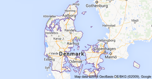
Copenhagen is on the island of Zeeland. It is connected by bridge to the island of Fyn which then is connected by bridge to the Jutland peninsula. After Krista and Sean arrived we spent one more night at the Ocean Hotel. The following morning, we drove east to Odense, on Fyn and stopped at the Hans Christian Andersen Museum. That afternoon we drove north on the Jutland peninsula to the city of Aarhus. Aarhus is a charming city with lots of character and many more things to do and see than we had time for during our short visit. We stayed with Kirsten, a longtime friend of Nancy’s family from when Nancy was born in Copenhagen. At the end of the week, we returned to Zeeland by ferry from Aarhus to Odden. Odden is on the tip of a very narrow peninsula on the northwest corner of Zeeland. It’s a beautiful area with farms and traditional Danish buildings.
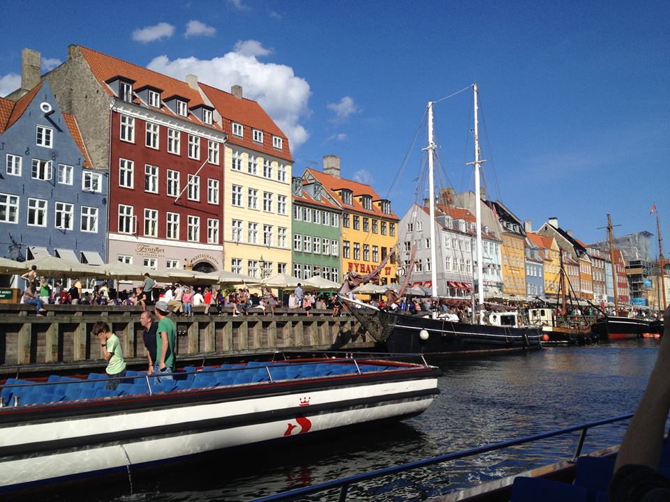
Copenhagen
– Nyhaven is a 17th century waterfront and canal built by King Christian V from 1670 to 1673 and dug by Swedish war prisoners. It is a narrow channel from the sea to the old inner city at Kings Harbor where ships handled cargo and fishermens’ catch. Danish author Hans Christian Andersen lived at Nyhaven for 18 years.
Ocean Hotel
 .
.
The garden outside the hotel.
Our car for the week, a Skoda Octavia manufactured in the Czech Republic, outside our hotel. We really liked this car.

Oar Hus kayak storage building nearby.
Odense
– Hans Christian Andersen Museum
http://museum.odense.dk/en/museums/hans-christian-andersen-museum
He lived here as a boy and the city of Odense is proud of it. Everything you would like to know about HCA is in this museum. He traveled extensively thoughout his life, one time staying with Charles Dicken’s family in London for a month. Dicken’s daughter said that Andersen was a bore and couldn’t wait for him to leave. Dickens said that Andersen’s command of English was terrible and wondered if Andersen could speak Danish very well. However, Andersen said that he had a great time at the Dicken’s home and regretted having to leave.
Aarhus
– from Wikipedia
“Aarhus is one of the oldest towns in Denmark, with settlements dated to the late 8th century and a bishopric from at least 948. By the end of the Middle Ages, it had also grown to become one of the largest towns in the country. Trading and seafaring continued to flourish until the 1570s, when growth stagnated. Grain exports initiated a new period of prosperity in the mid-18th century. Factories of various types were established and, from 1810, the harbour was expanded. Regular steamship links with Copenhagen began in 1830, and Jutland’s first railway was established in 1862 from Aarhus to Randers.
While Aarhus became an important railway hub, the harbour provided a sound basis for seafaring and commerce, initiating significant industrial growth in the city in the second half of the 19th century, soon making it Denmark’s largest provincial city. With the establishment of Aarhus University in 1928, the city continued to grow, becoming the most important business centre in Jutland by the 1950s. During World War II, the Gestapo had their Danish headquarters in the city and kept their archives there until they were destroyed during a raid in October 1944. Today Aarhus is Denmark’s second most important centre of research and education, and the electronics and metallurgy sectors have also continued to expand.”
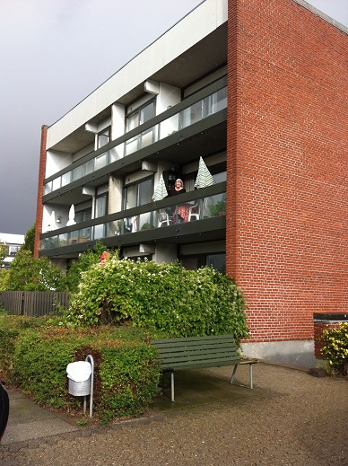
Kirsten’s apartment.
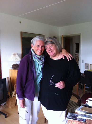
Nancy and Kirsten.
– Den Gamle By / Old Town
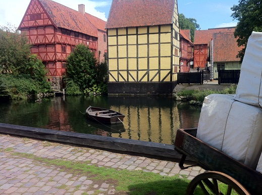
http://www.dengamleby.dk/the-old-town
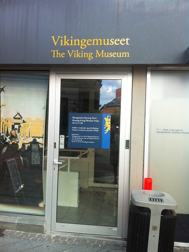
– Viking Museum
A Viking site from around 900 discovered 3 meters below ground during excavations for the Nordea bank building in 1960. It is accessible from this door on the side of the bank. Each step down the stairs is marked with the corresponding year of that level.
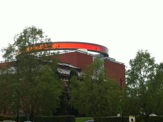
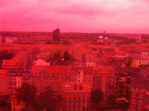
– Aros Art Museum
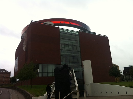
http://en.wikipedia.org/wiki/ARoS_Aarhus_Kunstmuseum
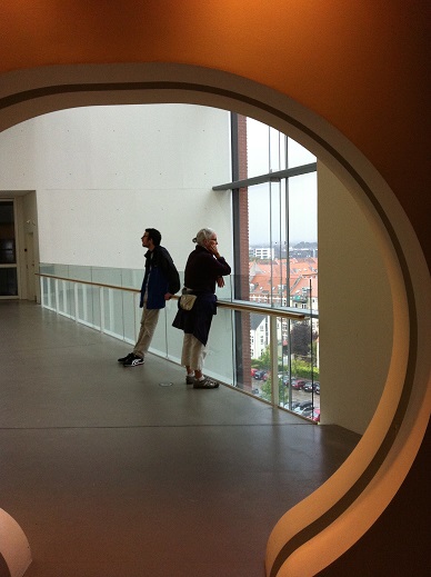
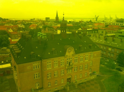
Views from the circular roof rainbow platform
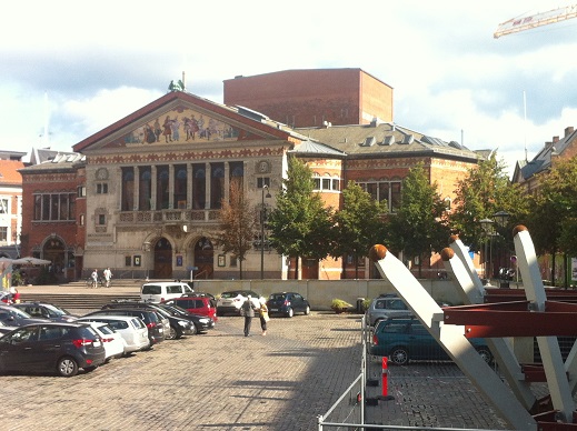
Aarhus Theater
Ebeltoft
Ebeltoft is on the other side of the bay from Aarhus.
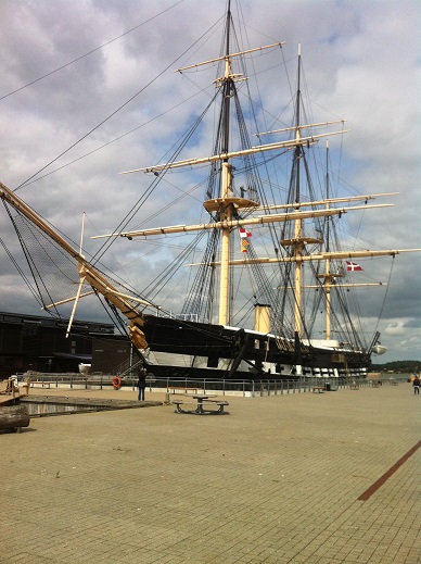
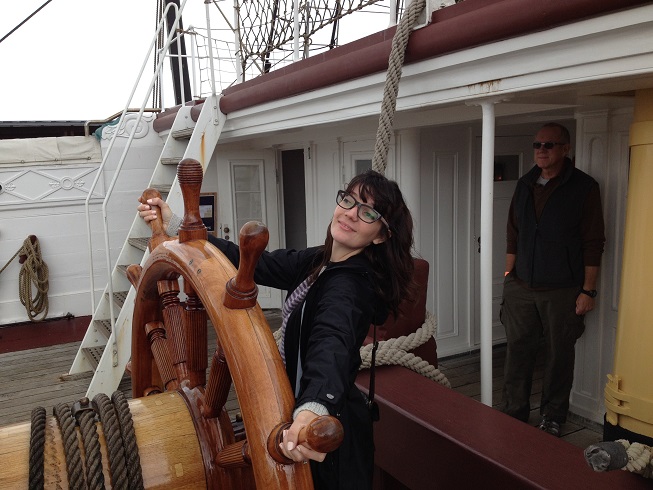
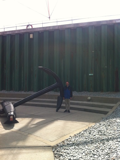
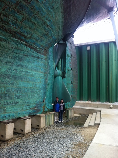
– Frigate Jylland
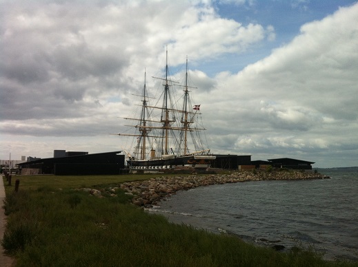
Jylland is one of the world’s largest wooden warships and is both a screw-propelled steam frigate and a sailship. She was built in 1860 and was engaged in naval action during 1864. In the 1890’s she was reduced to stationary use and was almost scrapped in 1908. At one point, she sank in the Copenhagen harbor but was later raised. She was towed to Ebeltoft in 1960 and placed in dry dock in 1984 at which point restoration began. Now fully restored with 60 % of her timber replaced, she is an interactive museum.
http://en.wikipedia.org/wiki/Danish_steam_frigate_Jylland
– Fregatten Jylland
http://www.fregatten-jylland.dk/
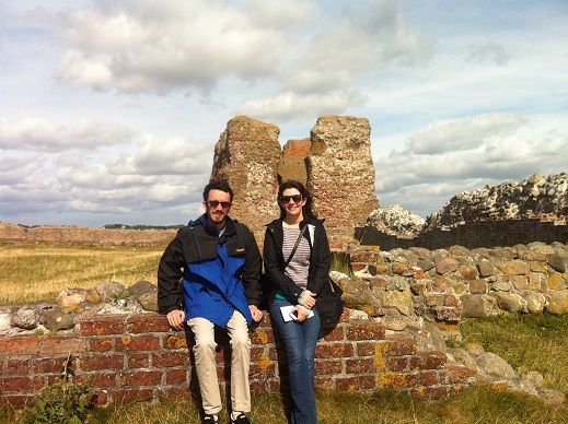
– Kalo Castle ruins
King forced peasants to build castles
– by Mette Svart Kristiansen
New taxes were no less popular in the Middle Ages than now. In 1312-13, Jutland peasants and nobles rose up against King Erik VI and his many costly wars. The King quashed the uprising, executed its leaders, levied a penalty tax called grains of gold”, and forced the peasants to build castles at Kalø, Viborg, Horsens and Struer. “… and so at last he conquered the Jutlanders’ old obstinacy…” reads the gloating account in the Chronica Sialandie. The castles were so unpopular that the next monarch, King Christopher II, had to promise to tear them down. Old foundations at Kalø indicate that this duly happened to some extent, but also that the castle was soon rebuilt, probably by King Valdemar IV (1340-1375). ”
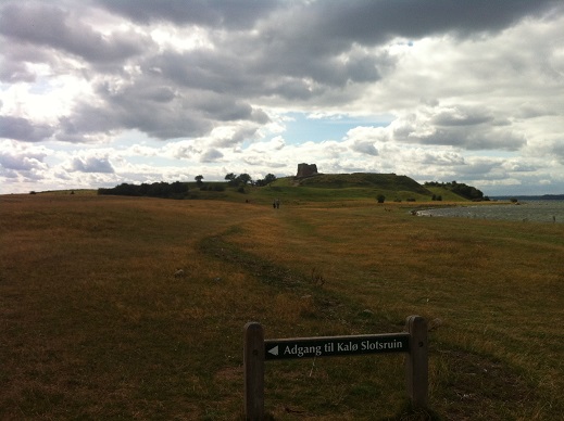
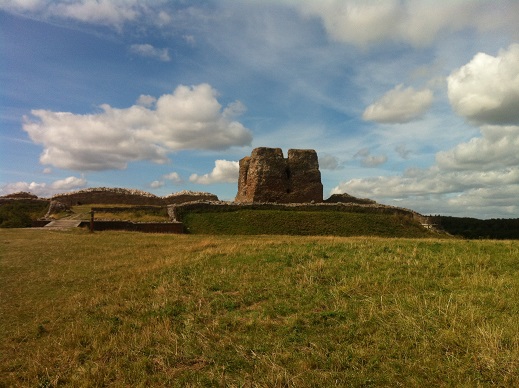
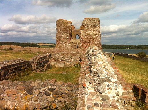
http://en.wikipedia.org/wiki/Kal%C3%B8_Slot
Roskilde
– The Viking Ships Museum
– from the Wikipedia page
“The Viking Ship Museum (Danish: Vikingeskibsmuseet) in Roskilde is the Danish national museum for ships, seafaring and boatbuilding in the prehistoric and medieval period.
Around the year 1070, five Viking ships were deliberately sunk at Skuldelev in Roskilde Fjord in order to block the most important fairway and to protect Roskilde from enemy attack from the sea. These ships, later known as the Skuldelev ships, were excavated in 1962. They turned out to be five different types of ships ranging from cargo ships to ships of war.
The Viking Ship Museum overlooks Roskilde Fjord and was built in 1969 especially to exhibit the five newly discovered ships. In the late 1990s excavations for an expansion of the museum uncovered a further 9 ships including the longest Viking warship ever discovered, at 36 metres.”
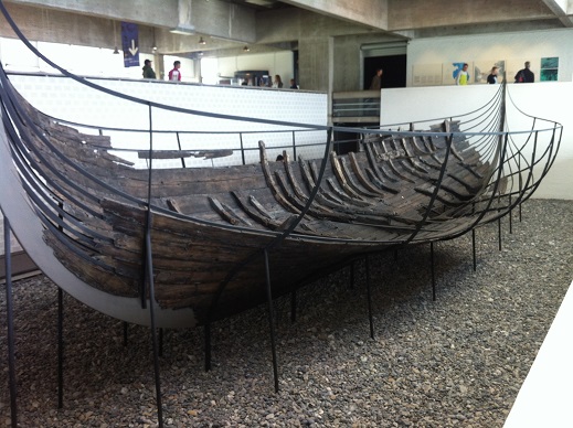
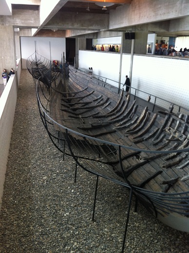

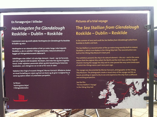
The Sea Stallion from Glendalough was built based on one of the ships excavated at Skuldelev. She was sailed from Roskilde to Dublin and back in 2007 and 2008.
http://www.vikingeskibsmuseet.dk/en/
http://www.vikingtoday.com/ships/denmark/seastallion-from-glendalough.htm
Sweden
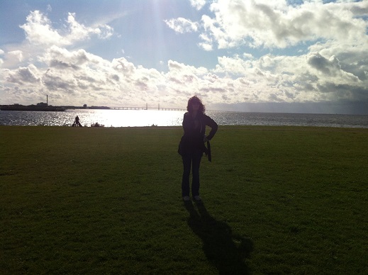
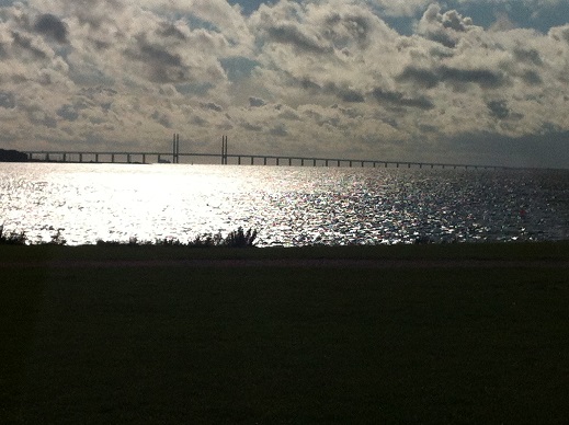
– The Oresund Bridge connects Copenhagen to Malmo, Sweden
http://en.wikipedia.org/wiki/%C3%98resund_Bridge
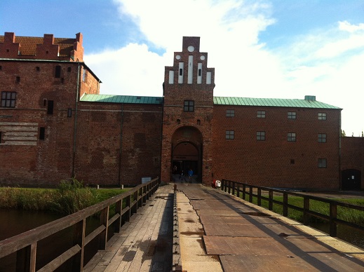
– Malmo Castle, Southern Sweden
The first castle was founded in 1434 by King Eric of Pomerania. This structure was demolished in early 16th century, and a new one was built in its place in the 1530s by King Christian III of Denmark. It was one of the most important strongholds of what was then Denmark.
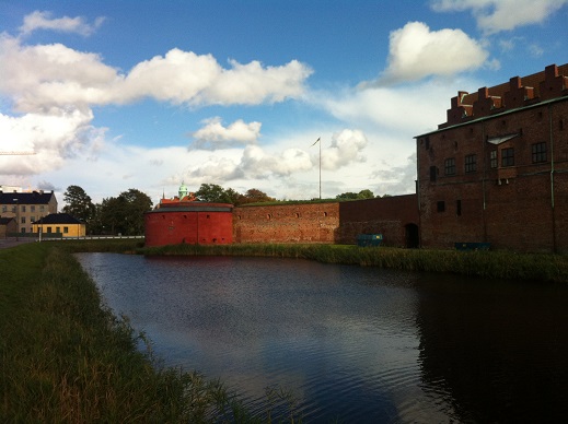
http://en.wikipedia.org/wiki/Malm%C3%B6_Castle
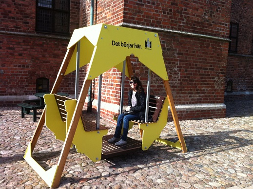
“it starts here” – in Swedish
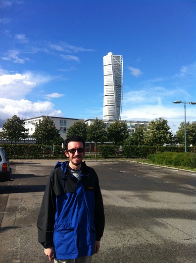
– Turning Torso building
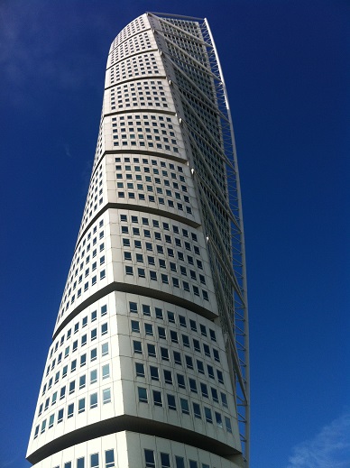
Plenty of facts and figures on the Turning Torso at this web site:
http://www.designbuild-network.com/projects/turning-torso/
Back to Copenhagen
– Cafe Kystens Perle
One of our favorite restaurants in Denmark. 634 Kroner for 2 hamburgers, 2 Spanish sandwiches & 4 beers. That’s about $114. We could live in Denmark if it only wasn’t so expensive!
http://www.cafekystensperle.dk/
–
The Streets of Morocco


